As a result of global warming, hurricanes will become common in Europe in the next few decades. I discuss the evidence, the impact and the need for proper contingency planning.
Some terminology
Tropical cyclones
A tropical cyclone is a rapidly rotating storm system with a low-pressure centre, strong winds, and a spiral arrangement of thunderstorms that produce heavy rain. They are called “tropical” because they form almost exclusively over tropical or sub-tropical waters. “Cyclone” refers to their winds moving in a circle, rotating around a central clear eye. The winds blow counterclockwise in the Northern Hemisphere and clockwise in the Southern Hemisphere.
For completeness, an anticyclone is a large-scale circulation of winds around a central region of high atmospheric pressure, clockwise in the Northern Hemisphere, counterclockwise in the Southern Hemisphere”. Anticyclones are not storm systems, and in Belgium, where I used to live, the famous1 Azores Anticyclone usually lead to nice weather.
Storms, hurricanes and typhoons
The terms “hurricane” and “typhoon” refer both to powerful tropical cyclones. A hurricane2 occurs in the Atlantic Ocean and northeastern Pacific Ocean, and a typhoon3 occurs in the northwestern Pacific Ocean4. The diameter of the hurricane is typically of the order of hundreds of kilometers. Last month’s hurricane Florence was over 600 km in diameter, and typhoon Trami about 500 km. A “tropical storm” is “tropical cyclone” that is less strong than a hurricane or typhoon.
Strength and potential damage
The Saffir-Simpson Hurricane Wind Scale is a scale from 1 to 5 based on a hurricane’s sustained wind speed, used to estimate potential property damage. Hurricanes reaching Category 3 and higher are considered major hurricanes because of their potential for significant loss of life and damage. However, Category 1 and 2 hurricanes are still much more dangerous than ordinary tropical storms, and require preventive measures.
The amount of energy in a hurricane is very large. NOAA (US National Oceanic and Atmospheric Administration) notes that the energy released by an average hurricane “is equivalent to 200 times the world-wide electrical generating capacity”.
The table below is adapted from NOAA page linked above.
| Category | Sustained wind speed | Extent of damage |
|---|---|---|
| 1 | 119-153 km/h | Very dangerous winds will produce some damage: Houses could have damage to roof, shingles and gutters. Large branches of trees will snap and shallowly rooted trees may be toppled. Extensive damage to power lines and poles likely will result in power outages that could last a few to several days. |
| 2 | 154-177 km/h | Extremely dangerous winds will cause extensive damage: Houses could sustain major roof and siding damage. Many shallowly rooted trees will be snapped or uprooted and block numerous roads. Near-total power loss is expected with outages that could last from several days to weeks. |
| 3 | 178-208 km/h | Devastating damage will occur: Houses may incur major damage or removal of roof decking and gable ends. Many trees will be snapped or uprooted, blocking numerous roads. Electricity and water will be unavailable for several days to weeks after the storm passes. |
| 4 | 209-251 km/h | Catastrophic damage will occur: Houses can sustain severe damage with loss of most of the roof structure and/or some exterior walls. Most trees will be snapped or uprooted and electricity poles downed. Fallen trees and electricity poles will isolate residential areas. Power outages will last weeks to possibly months. Most of the area will be uninhabitable for weeks or months. |
| 5 | 252 km/h or higher | Catastrophic damage will occur: A high percentage of houses will be destroyed, with total roof failure and wall collapse. Fallen trees and electricity poles will isolate residential areas. Power outages will last for weeks to possibly months. Most of the area will be uninhabitable for weeks or months. |
Note that this table uses sustained wind speeds. The gusts occuring during a tropical cyclone can be a lot stronger than this (typically about 30% stronger), and are usually what is quoted in the media.
Global warming causes hurricanes to get stronger
Slightly simplifying, hurricanes get their energy from the heat in the surface sea water. As the planet gets warmer, the sea surface gets warmer, which leads to stronger tropical cyclones.
There is plenty evidence for this trend. For example, very recent work by my friend and colleague Prof. Takemi of the Disaster Prevention Research Institute (DPRI) of Kyoto University [1] used observation data of historical typhoons to reproduce them in simulation, and then simulated the effects of future warmer conditions. They conclude that both wind speed and precipitation would increase significantly. When I visited DPRI in September, a researcher explained me their latest simulations. With 2 degrees warming, wind speeds and rainfall during a typhoon could double.
The recent Guardian article “Is climate change making hurricanes worse?” provides a good overview. Note that this trend refers to all tropical cyclones, not just these that made landfall.
Hurricanes are coming to Europe
Historically, none of the tropical storms in Europe in the last century except hurricane Vince in 2005 have been hurricanes, no matter how severe they might have seemed. However, this is about to change.
As hurricanes get more powerful and last longer, the chance that they can reach Europe grows. Again, there is evidence for this. Already in 2013 Reindert Haarsma, Senior Scientist at the Royal Netherlands Meteorological Institute wrote the article “The future will bring hurricanes to Europe” which gives a good overview. The article is based on Haarsma’s scientific research [2]. Other researchers predict similar trends [3,4,5].
Impact and contingency planning
Hurricanes do not only cause damage because of the strong winds. They also lead to flash floods because of the very heavy rainfall that they cause (often 30-50 cm/h), and because of the storm surges which are several meters in height (e.g. 5 m for hurricane Michael a few weeks ago).
To put this into perspective, in December 2015 storm Desmond broke the United Kingdom’s 24-hour rainfall record with 34 cm of rainfall in 24 hours, and led to widespread flooding in the UK and Ireland. The only storm surge on record comparable to those caused by hurricanes was the notorious Great Storm of 1953. In Scotland, where storms are common, this was the worst storm5 in 500 years.
Better flood defenses are therefore absolutely crucial to deal with future hurricanes. As a result of the 1953 disaster, much was done in the UK, the Netherlands and Belgium to strenghten flood defenses, but these focus on the North Sea. Similar works on the coasts facing the Atlantic will be necessary. Furthermore because of the increased damage, power outages and disruption of supplies will last much longer than for the storms we have now and therefore contingency plans will have to be put in place. A capability for accurate forecasting of hurricane trajectories is necessary for timely evacuation of people in the affected areas.
The good news is that Europe can benefit from the extensive know-how developed for example in the US and Japan, both in predictions and in dealing with the effects of such severe weather events.
References
[1] Kanada S, Takemi T, Kato M, Yamasaki S, Fudeyasu H, Tsuboki K, Arakawa O, Takayabu I. A multimodel intercomparison of an intense typhoon in future, warmer climates by four 5-km-mesh models. Journal of Climate. 2017 Aug;30(15):6017-36.
[2] Haarsma RJ, Hazeleger W, Severijns C, De Vries H, Sterl A, Bintanja R, Van Oldenborgh GJ, van den Brink HW. More hurricanes to hit western Europe due to global warming. Geophysical Research Letters. 2013 May 16;40(9):1783-8.
[3] Baker A, Hodges K, Schiemann R, Vidale PL. North Atlantic post-tropical cyclones in reanalysis datasets. In EGU General Assembly Conference Abstracts, 2018 Apr (Vol. 20, p. 14606).
[4] Dekker MM, Haarsma RJ, de Vries H, Baatsen M, van Delden AJ. Characteristics and development of European cyclones with tropical origin in reanalysis data. Climate Dynamics. 2018 Jan 1;50(1-2):445-55.
[5] Mousavi ME, Irish JL, Frey AE, Olivera F, Edge BL. Global warming and hurricanes: the potential impact of hurricane intensification and sea level rise on coastal flooding. Climatic Change. 2011 Feb 1;104(3-4):575-97.
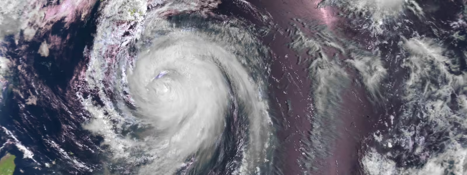
The banner image shows typhoon Halong approaching Japan in September 2014, © NASA Terra/MODIS 2014
-
It is so famous that a travel book shop in Brussels took it as its name.
↩ -
The term “hurricane” derives from the Spanish word huracán, which in turn probably derives from the Taino (an indigenous people of the Caribbean) word hurakán “god of the storm”.
↩ -
In Japan they are called 台風 (taifuu) and are given numbers rather than names.
↩ -
In the northwestern Pacific, the term “super typhoon” is used for tropical cyclones with sustained winds exceeding 240 km/h.
↩ -
This was a European windstorm, a type of extratropical cyclone, caused by different weather phenomena than hurricanes. There is evidence that this type of storms is also getting stronger [5]. ↩